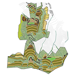
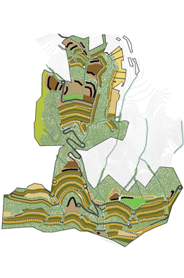
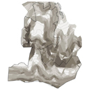
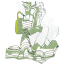
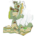
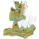
The topography of the hill lends itself ideally to the concept of a ‘Wilderness City’. The 600 acre hill forms a series of buttresses descending steeply down in massive steps to plateaus of flat land on its shoulders. Each shoulder with its flat top is surrounded by a roughly semi-circular downward sloping spread, interspersed with water courses. The upper reaches of the massif form linear terraced slopes. At the edges of the site to east and west the land falls steeply into cliffs with rich vegetation and fauna. The ridge along the top descends into forest lands.
The design maximizes the impact of these flat plateau lands. Girdling them are secondary roads which connect clusters of residential plots. Each cluster is a micro community within the larger whole with its distinct identity; with an amenity or leisure activity at its core; such as a landscape feature, an amphitheatre, putting green, basketball court; or a building like a small amenity shopping and coffee shop, clinic, crèche, club or spa.
At the heart of the residential communities stretches the central plateau covering approximately 25 acres. It is perceived as the iconic focus of the township. A town centre of great interest and beauty; it will attract people from far and wide, as a destination. The central plaza holds a cultural complex with auditoria, amphitheatres, and a theatre district for visiting thespians during the many festivals held here. A smaller plateau above holds a sports stadium.
The central plateau divides the township into lower and upper districts-
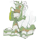
Phase I being the lower shoulders of the hill with affordable housing clusters, amenities and facilities like the club, a convention centre, the auditoria for the cultural plaza, a community clinic, a residential school, parking facilities etc.
In Phase II the upper slopes which are steeper, more difficult but with spectacular views are developed. The topography here yields a more linear terraced development and buildable land is at a premium. The plots are large with scattered houses. The hospitality and leisure functions include a resort, a promenade and trekking trails, camps etc.
Phase III is the area to the east and west of the site, here the land is too steep to permit easy development. This area is designated for camping, outdoor picnics, nature trails, etc. with some forest cottages along the flat terraces.
The valley below the hill is planned as a verdant development for Bio tech, or other corporate functions set amidst organic farms; all set around water harvesting moats from the hill above. The presence of rock outcrops, dense tree growth, socially important elements like the ancient temple and well, features which are potential ‘beauty spots’ like waterfalls, will be studied and enhanced during detailed planning. The entrance plaza, the plateau central plaza, the cluster nodes form the urban character of the entire development. Each of these have a unique identity which enhances their function and appeal. These areas have highly detailed landscape features.
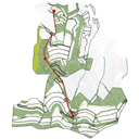
Like all hill developments the main arterial links are wide, continuously rising at gradients from 1:8 to 1:12 and traversing diagonally from east to west and back as they rise to the ridge above. This main system is mostly linear, while secondary roads loop and cross link to connect individual clusters and functions. Tertiary road and path systems enable treks, trails and footpaths linking view points and short cuts across the hill face.
An alignment for a funicular was studied as an alternative to the more conventional road approach. Commencing at the valley floor, elevated over the lower slopes, it would rise steeply up to the first plateau. It serves holiday makers and people coming up for the day to enjoy the cultural and leisure functions of the ‘Central Plaza’.
The system would continue to rise up the higher hill to the ridge, with a restaurant, spa, hotel and other facilities. The funicular would make a series of stops, it would be comfortable, allowing local residents to alight at the most convenient stop. People could choose to leave their cars behind in the central parking below. This would ease traffic pressures on the road, especially during weekends when there are more visitors.
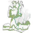
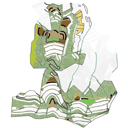
The Idyllwild Township is designed to maintain the biodiversity and flora fauna on the hill. The plan layers housing and access with green corridors running both across the hill faces as well as pockets of dense green which are left undisturbed at critical junctures. From the valley a screen of greenery and the very recessive nature of the built form make the township verdant and camouflaged. Folds in the hill face and riparian corridors are left undisturbed. They are enhanced by a series of small and medium check dams to hold rain water for the township. Sewage treatment and solid waste are managed at local levels. The agrarian valley floor is maintained in partnership with the community as market gardens and grey water led to enhance the fields.
The unique township is based on a self governance model with residents offering skills and community time.
